Photography -Trawling for Light rays
Introduction
I have always had a complex relationship with photography - vision plays a dominant role in how humans perceive and interact with the world. Before digital cameras this relationship was bound by the cost and mechanics of using film. With digital cameras that relationship exploded into a daily habit as it has done so for millions of other human beings too! The internet article How many photos?[1] puts this into perspective for me.
In the year 2024, every 13 days the world takes as many photos as were taken globally in 1998 at the peak of film photography.
That’s a lot of people taking photos and that includes me. Initially like almost everyone else my smart phone became my primary camera. Unlike film which required you to process it to see the photographs, digital versions appear instantly and your device stores them by default. That is a massive improvement over working with film, something that was largely reserved for use on vacations for me.
This scenario was common for many individuals and it has worked well in most cases. Now to explain the complex relationship I have with photography it becomes beneficial to describe a rough timeline to drone photography.
Timeline
Smart phones hit the market in 2007[2] and I watched the Apple World Wide Developer Conference (WWDC) online and decided I would be a mobile developer for Apple’s iPhone!
After a couple of years as a mobile developer I was fortunate to work for Cox Automotive and began writing code to manage digital media files on iPhone devices. Later on I got to work on a VIN[3] scanner for multiple mobile applications at Cox Automotive. Through this work, I learned extensively about managing and distributing digital images. I improved the performance and memory usage of the VIN scanner. I also packaged the VIN Scanner code into a framework for distribution within Cox Automotive.
The next pivotal moment was when I decided to take the computational photography course at Georgia Tech (CS 6475)[4]. This course was hard and really stretched me but was very rewarding to complete. It taught me the basics of the computational photography pipeline. From illumination for the optics that focus the image for the sensor to collect. To the image being processed for display and available to end users to create new digital media.
One example of new media I was exposed to was the pano. The software stitches multiple overlapping images from the same location to form a single expansive image with an aspect ratio of 2:1 (generalizing). To build a pano you need to understand digital images and the data structure that backs them, the 3D array. For the course we used Python and it was my first working introduction to NumPy[5]! I found great enjoyment in building and exploring panos.
The final piece of the puzzle was the drone itself. The very word drone had a monumental impact on me as a child reading the science fiction works of Iain M Banks[6]. The Culture[7] is dominated by the actions of drones which are considered fully sentient members of a post-scarcity[8] society.
Being connected to the Culture in even such vague terms has significance for me. I purchased my first drone (Mavic Pro 2) and set about studying for the FAA remote pilot’s certification (part 107). It was important to me to use the FAA documentation to achieve my certification. I joined AMA[9] and found a local model airfield to start training myself on the drone’s controls. In 2022 I passed the FAA exam and began exploring different locations.
Location
For photographers, location is paramount, as it decides many aspects of what is possible on an assignment. With drone photography there are legal requirements to flying your drone that must also be considered as part of the assignment. For example, do you plan to fly over people? Put simply your location dictates what exactly you can do with your drone.
I am fortunate in that I live on the Olympic Peninsula in Washington state which gives me lots of mountains, forests and sea to explore. I enjoy hiking and being outdoors in general and drone photography is an extension to those activities. The big landscapes where I live really encourage me to take drone panoramic photos (panos) as well as photos from new perspectives.
Landscapes
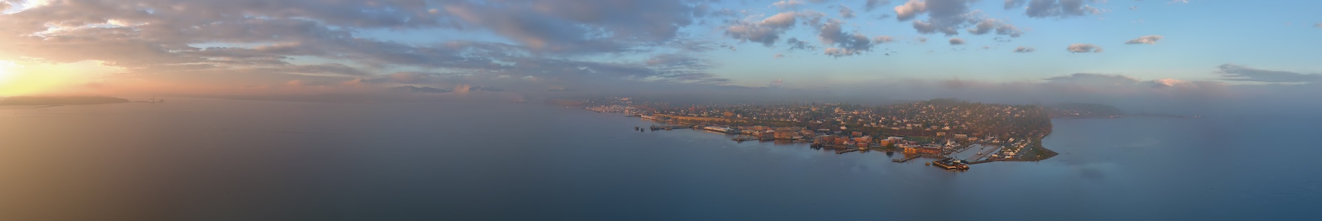
I have come to the conclusion that panoramic photos are an extension of the landscape format (2:1) with two major exceptions. First the pano has a significantly wider field of view than that of a standard landscape photo. Secondly the pano will be much bigger in size given that it is a collection of photos stitched together.
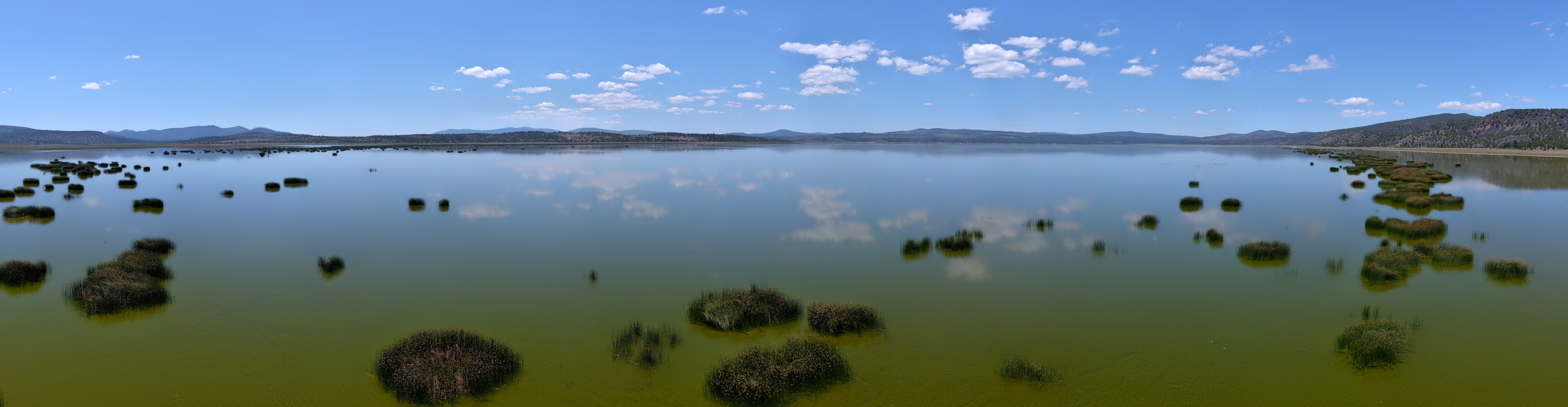
I built the pano shown above using 12 individual photos. I assembled it as 2 rows of 6 photos, first row is from left to right. Second row is right to left. It’s clear that a single photo could not capture the detail and expanse of the pano. To capture it all in a single photo would require you to shoot from so far away there would be no real detail in the photo.
New Devices, New Imagery
A drone’s camera gets a different view of the terrain that is not available to humans without considerable effort, if even possible at all. Without a FAA wavier and excluding AMA sites most drones operate within a maximum altitude of 400 ft. I believe this puts drones in a special place - literally! Most low-flying aircraft activity happens at 500ft, excluding the military. This does not include take off, landing and helicopters. Drones work and operate in the > 400ft space. Nearly all other aircraft simply pass through that height while ascending or descending. Flying a number of drone models has left me with the definite impression that drones fly like insects more than anything else I can think of.
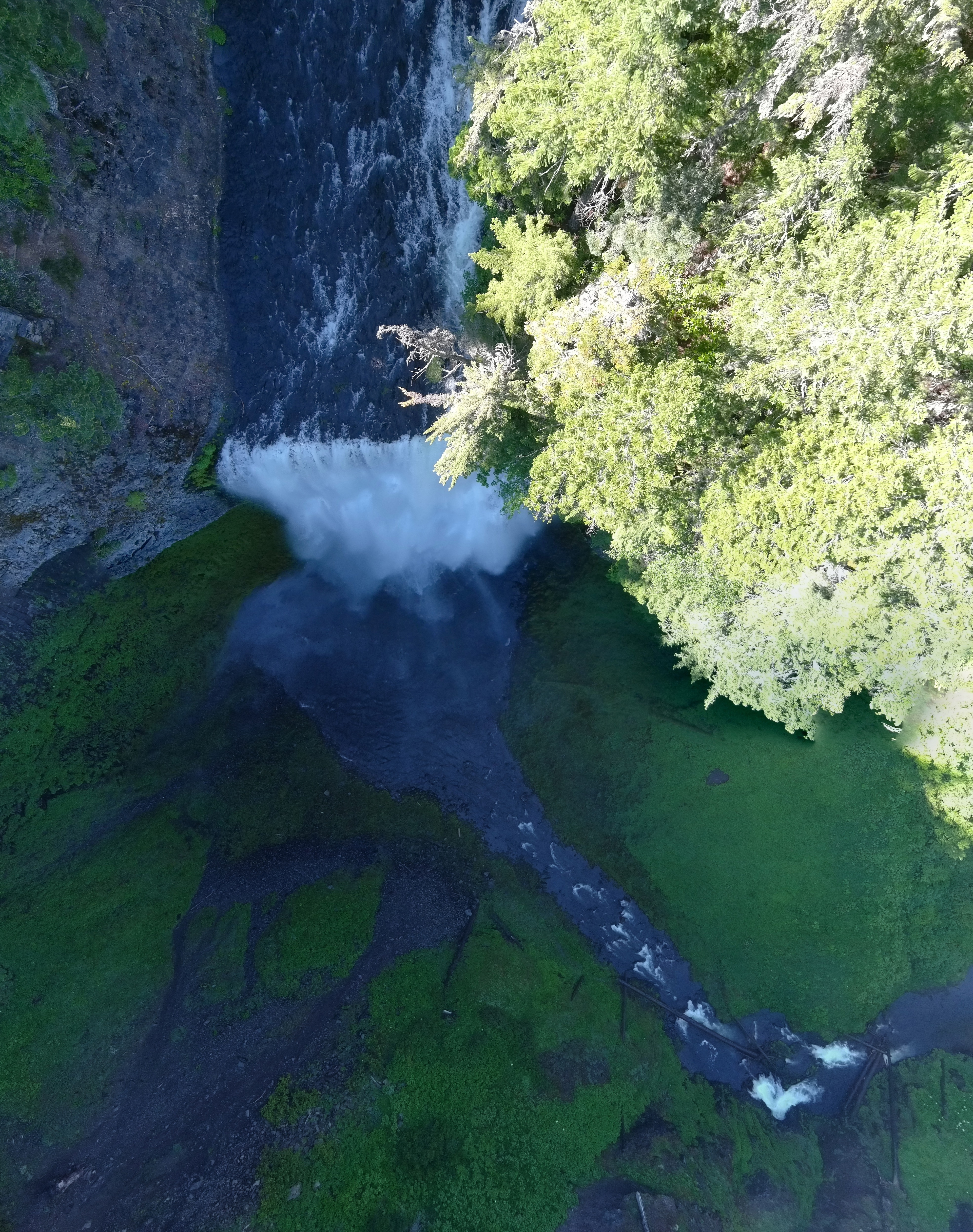
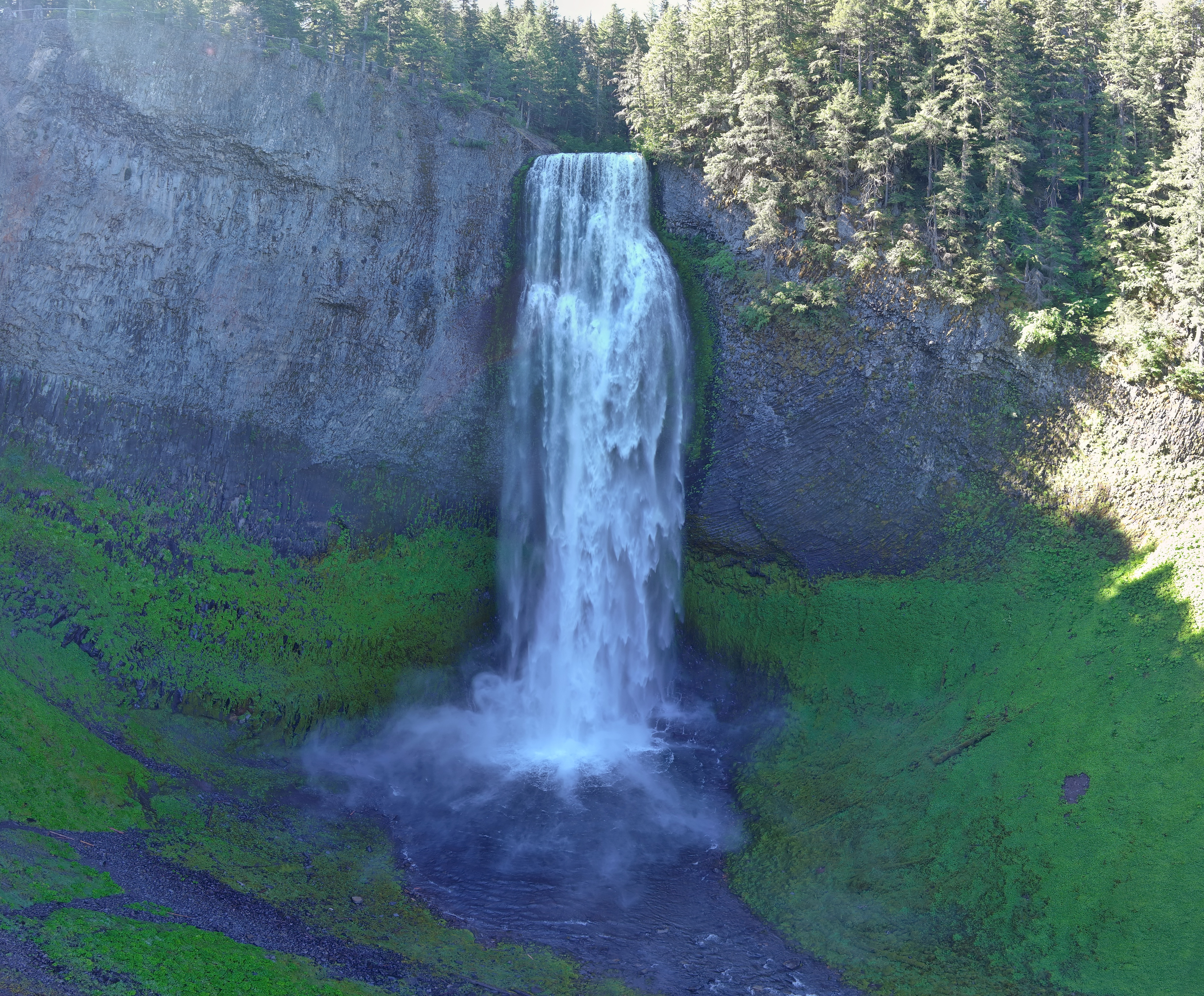
The drone’s ability to hover and get high compared to a human gives the drone pilot access to hundreds and thousands of new images. I experience an intimacy with the terrain flying at 400ft or less which I have attempted to capture. The above photo of Salt Creek falls in Oregon exemplifies this for me. The next photo is for comparison and is a more traditional image of a waterfall.
Conclusion
Wandering the Olympic Peninsula in Washington state US, in search of light rays to capture has and continues to be a delightful experience for me. I continue to learn new concepts such as topographic prominence[10] and civil dawn, nautical dawn and astronomical dawn[11][12]. I have come to realize there are hundreds of thousands of opportunities to capture light rays, or more concisely photographs to take every day. You don’t get all of them, but you can choose the ones you think you want. 😉
Writing articles on subjects that matter to me helps solidify my ideas and thoughts. I struggled for months before finally sitting down to write this one. As I wrestled with this article on photography I realized the action I needed to do the most - share my photography. I set up the website 400ft.org[13] to document my drone flying experiences and put a portfolio together on 500px.com[14] to share my photography.
May the adventure continue!
Resources
- https://dmalitz.substack.com/p/how-many-photos
- https://en.wikipedia.org/wiki/IPhone_(1st_generation)
- https://en.wikipedia.org/wiki/Vehicle_identification_number
- https://omscs.gatech.edu/cs-6475-computational-photography
- https://numpy.org
- https://en.wikipedia.org/wiki/Iain_Banks
- https://en.wikipedia.org/wiki/The_Culture
- https://en.wikipedia.org/wiki/Post-scarcity
- https://www.modelaircraft.org
- https://en.wikipedia.org/wiki/Topographic_prominence
- https://forecast.weather.gov/glossary.php?word=DAWN
- https://starwalk.space/en/news/difference-between-twilight-dusk-dawn
- https://400ft.org
- https://500px.com/p/phornsby